Databases management
VWorldTerrain technology is based on a principle of generation of geometry in real-time. In order to achieve this, we have to apply data (x, y, z coordinates) to the math equations which define the terrain rendering. These data are either:
- totally invented, as it is the case for modeling,
- or come from existing models, which are Digital Elevation Models (DEMs).
In order to achieve a high degree of realism, especially when we come to projects which are based on real-world
locations with real data, we indeed use existing models.
Three types of data are in fact used:
- DEMs (Digital Elevation Models), so as define topography (altitude)
- Satellite imagery, so as to display the right colors
- Information on the type of ground and vegetation cover.
1) Digital Elevation Models ( DEMs):
There are several types of DEMs, in terms of precision and according to the various ways they can be obtained, namely from:
- geographical maps: use of contour lines
- stereoscopic aerial pictures, so as to infer the corresponding ground relief
- radar measures: made most of the time by satellites or space probes.
In any case, those data are processed to make 3D terrain digital files, in which x and y generally express
geographical coordinates (latitude, longitude) and z (altitude, in meters).
E.g.:
The Earth model we used for Eingana:
 GTopo 30 (USGS) data, x, y precision = 1km, vertical precision = 1m ( i.e.42 000 kms x 21 000 kms)
Marineris Valley (Mars) model:
 MOLA space probe( NASA) data, x, y precision = 463 m, vertical precision = 1m
(i.e.2 000 kms x 1 000 kms).
Mount Saint Helens model:
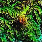 SDTS (USGS) data, x, y precision = 10 m, vertical precision = 0,1m
(i.e.30 kms x 30 kms).
Those files are represented by more or less large squares, depending on how precise they are; they have to be
assembled according to the desired surface area.
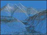
It is therefore by interpreting these altimetric coordinates in real-time that VWorldTerrain is able to display
simultaneously the desired environment’s topography.
 2) Satellite imagery:
After having recreated topography by linking up each point (altitude), we have to apply realistic texture
mapping to geometry.
The use of satellite pictures is of great help to achieve a realistic mapping, since these are vertical
pictures of the ground.
 There are various types of satellites, but the ones used for imagery are observation ones.They are about 800
kms above the Earth and possess a heliosynchronous orbit, which means these satellites are always in
line with the Earth and the Sun and take pictures at fixed times, with their back to the Sun.
These are 180 x 180 kms pictures. They contain various layers of information:
- 3 RGB (red, green, blue) channels, which represent the visible channels of the light spectrum
- 4 infrared channels (for remote-sensing: water, vegetation…)
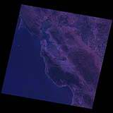 Unprocessed image
By mixing these RGB channels, we obtain the true colours of the original picture.

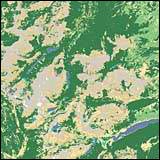
 3) Information on the nature of the ground and vegetation:
These data are provided by the satellite pictures infrared channels.
Indeed, after analysing and combining these channels, we can infer missing data on lakes and river network,
vegetation cover, etc ...
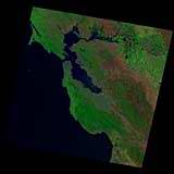
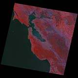 This research work, called remote-sensing, with a joint research job out in the field, along with a very precise
classification, results in the reproducing of the exact nature of the terrain with the corresponding vegetation,
at the appropriate location.
 Therefore using and processing those three types of data in real-time is the key to the three-dimensional
reconstitution of the universe accomplished by VWorldTerrain, with such an amazing realism.

